
Fall trio in the Laurentians
Autumn is upon us and with it are multiplying the opportunities for colorful getaways along quiet country roads. I offered myself, from the south or north, three loops in the Laurentians.
This article first appeared in the excellent magazine Vélo Mag, August 2021 edition.
Oka
The local trip (59 km)
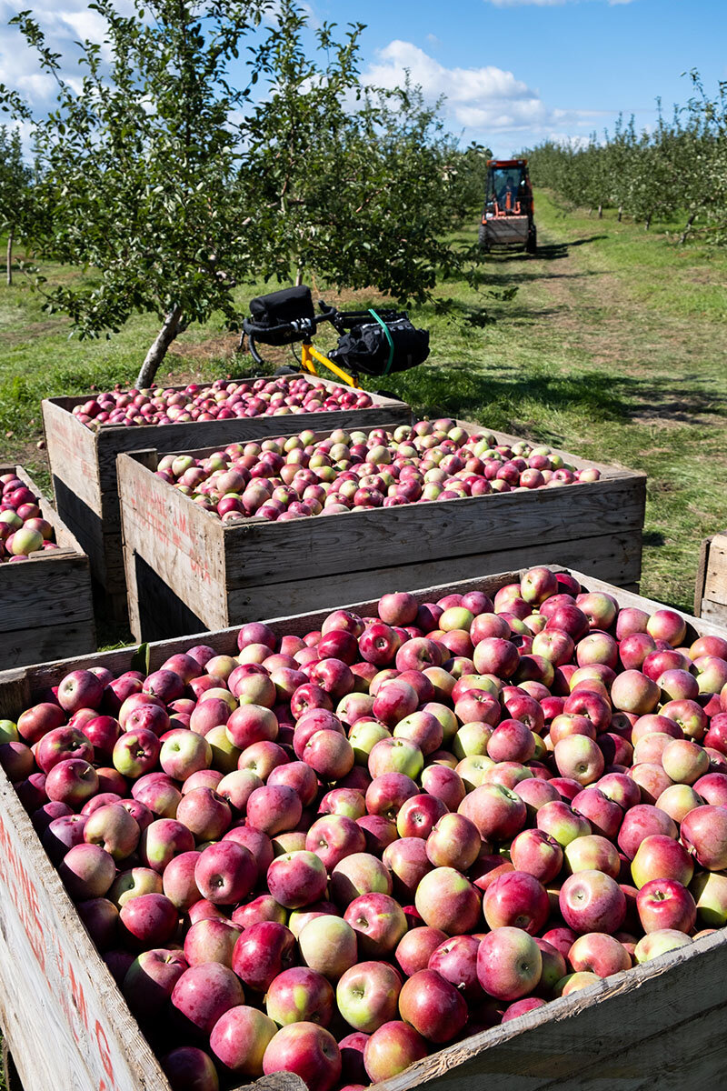
Oka and apples go well together in the fall.
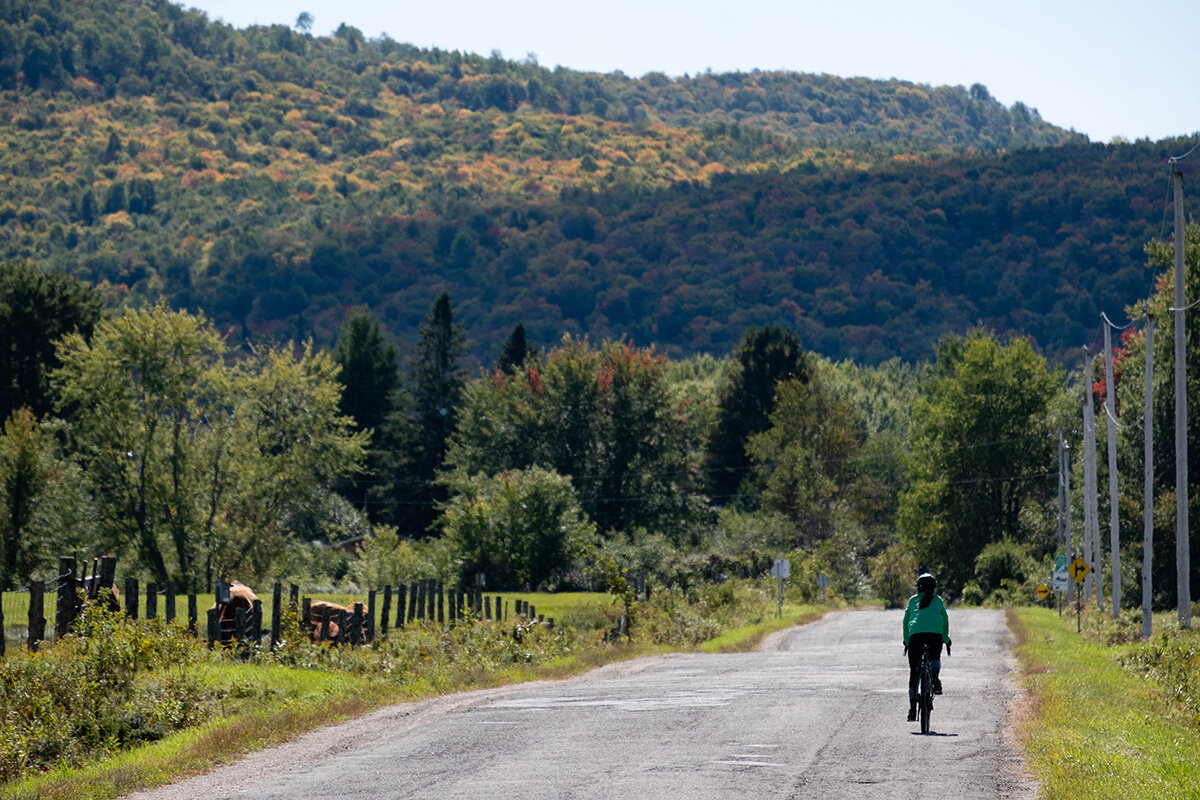
It's by consulting the official bike map of the Laurentians region - delivered with one of my Vélo Mag – that came to me the desire to better explore this land of gentle hills. And there is no better season than the apple season to discover the surroundings of Oka.
Leaving the bank where the Ottawa River spreads out to become Lac des Deux Montagnes, I start by climbing Rang de L'Annonciation. The forest encloses the road until it leaves only about twenty centimeters of shoulder. The space will widen, however, as I pass by charming old houses built from piece to piece, a stable, a few organic market gardeners and a sign indicating “You are in an agricultural municipality”.
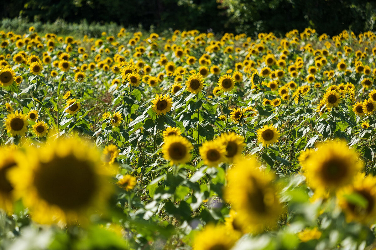
Orchards are everywhere and crowded. Some of the most popular are asking townspeople to park on the way in a bid to accommodate more people. As I walk away under a blue sky towards the village of Saint-Benoît by the rang Sainte-Sophie then the climb of the Côte-Rouge, I however have access to other more peaceful plantations. Between the orchards of apple trees and even pear trees are also lined up with fields of pumpkins, cabbage and huge sunflowers.

After a quick detour via rang Saint-Vincent, just to lengthen the journey slightly, I cross Saint-Benoît, home to several lovely brick residences. I force myself not to slow down my pedaling in front of the snack bar from which emanates the aroma of very tempting hot dogs.
From the irreproachable bitumen of Rang de La Fresnière, I can see Intermiel, sugar shacks, including the renowned Pied de Cochon shack, as well as Maison Lavande. I branch off towards Montée McMartin in the direction of Saint-Joseph-du-Lac where, as a good journalist, I buy a huge apple brioche still warm, before returning to Lac des Deux Montagnes at Pointe-Calumet.
The landscape changes briefly from rural to Beach Club before I embark on the La Vagabonde cycle path, which takes me back to Oka through its peaceful homonymous national park.
Mont Tremblant
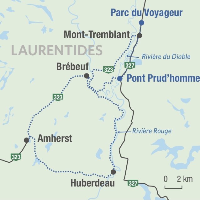
The covered bridge (68 km)
The Tremblant region offers an array of possibilities for everyone, from the towering mountain to the lesser-known paths of the historic villages of Mont-Tremblant, Saint-Jovite and a few others heading south-west. It is towards these towns that the Route des Belles-Histoires heads.
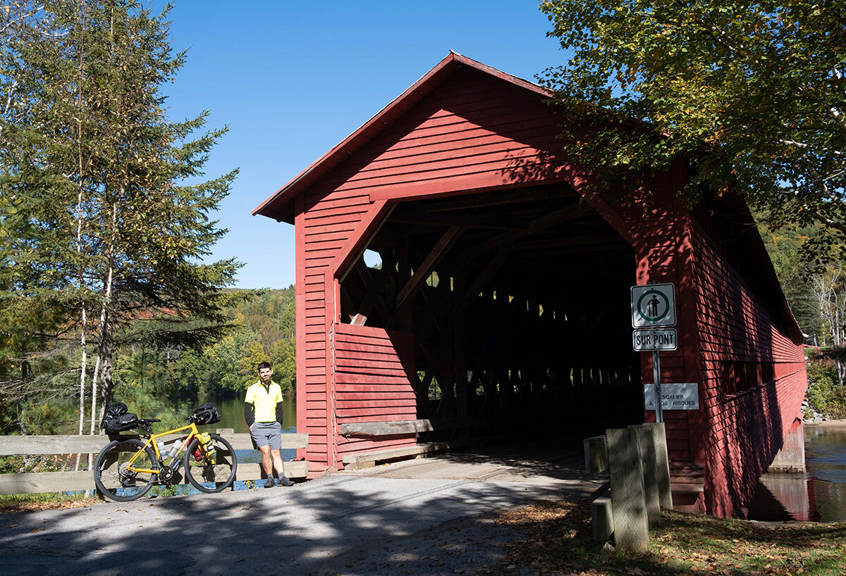
My sweetheart and I are starting our circuit at Parc du Voyageur, in front of the P'tit Train du Nord bike path, and where parking is free. By road 327, I go first for 8 km towards the Prud'homme bridge. It is this one – covered – which gives its name to the loop. Made of wood, 44 m long, it was built on the Diable River in 1918, in just six weeks and at a cost of $6000!
Unfortunately, the work, old and a bit crooked, is then closed to traffic at both ends. Even on bikes! It would take more to stop us, and we pass our bikes at arm's length over the fence. We will nevertheless return by another route, which can also be taken on the outward journey in order to dispense with this hitch to the rules.
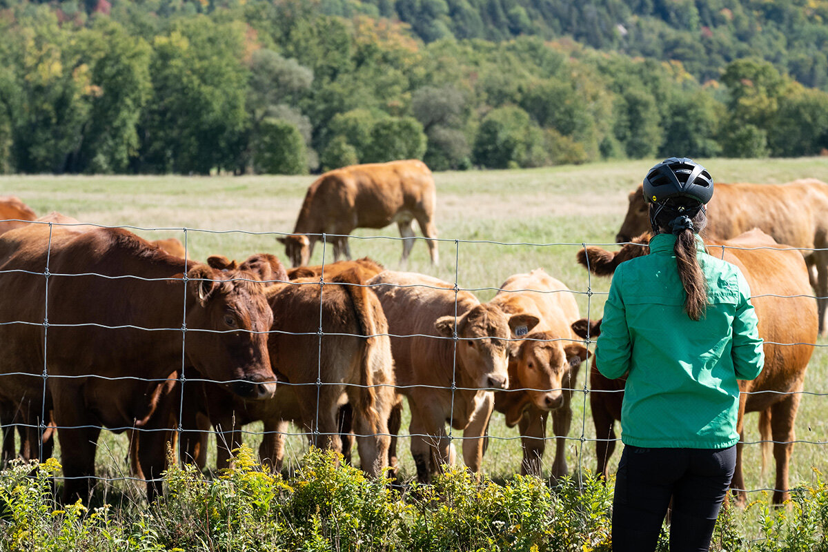
On the other side, we take our time on the way to the Tour-du-Carré, perhaps the most bucolic segment of the route of the day. The cattle farms extend over large rolling fields, and the hills flood the landscape with color. The cows, curious, slowly approach the road to watch us pass.
Gabrielle on the way to the Tour-du-Carré near Brébeuf.
The Prud'homme bridge over the Devil's River.
The charming municipality of Brébeuf is a paradise for antique diggers. I hold back my sweetheart from acquiring a gigantic glass jar, which I estimate to weigh around 40 kilos, and which would certainly go badly in my bottle cage!
We pass the bee farm Le Petit rucher du Nord, and the smooth shoulder of Route 323 leads us, in a series of descents and ascents, to a small park just before Saint-Rémi-d'Amherst. We picnic there on sturdy outdoor log tables.
We then have the choice, to get to Huberdeau, to take the Aerobic Corridor forest bike path, in gravel, or the Rockway Valley road. We climb the few steep slopes of the latter, rewarded by as many descents.
Passed Huberdeau, we veer right on Chemin de la Rouge, named after the pretty and winding river. Picnic tables are set up here too but we don't stop and continue on this road which has sections so recent that they have nothing to envy to the Gilles-Villeneuve circuit. Back in Brébeuf, we spot the superb sandbank in the middle of the river, accessible by footbridge and forming the municipal beach. The bottom of the air being already cool, we instead cross the bridge spanning the Chute aux Bleuets and veer left on Chemin de Brébeuf (route 323) to return to Mont-Tremblant, avoiding the bridge that is currently a little too covered.
In front of Lac Maskinongé, south of Mont-Tremblant.
Mont-Laurier
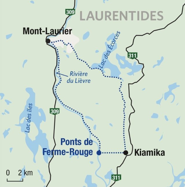
The twins of Ferme-Rouge (43 km)
Much more than just the starting or ending point of the P'tit Train du Nord, Mont-Laurier and its surroundings are hilly and dotted with rivers, lakes and beautiful roads with little traffic.
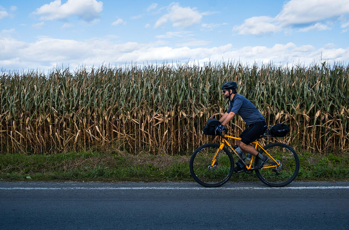
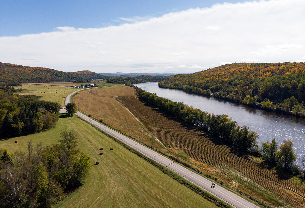
In just a few minutes, I find myself outside the city of approximately 15 inhabitants and begin a beautiful descent towards the south on the Adolphe-Chapleau road. In this fall, the ears of corn are high and packed like North Korean soldiers.
Just to my right slowly flows the Lièvre River. In the pastures, bovids appear, scattered near the multicolored woods.
As in the surroundings of Mont-Tremblant, I travel on the Route des Belles-Histoires. In fact, it covers more than 284 km from one end of the Laurentians to the other, and includes some sixty points of interest. One such story is that of Jos Montferrand, a famous 1830th century lumberjack and log driver, who worked here in the early XNUMXs.
The Montferrand epic is recounted in writing between the two splendid covered bridges of La Ferme-Rouge. These, built in 1903 and 53 m and 79 meters long, cross the Lièvre river by landing on an island in the center. I eat my lunch at the halt in the shadow of the muscles of the statue of the legendary French Canadian.
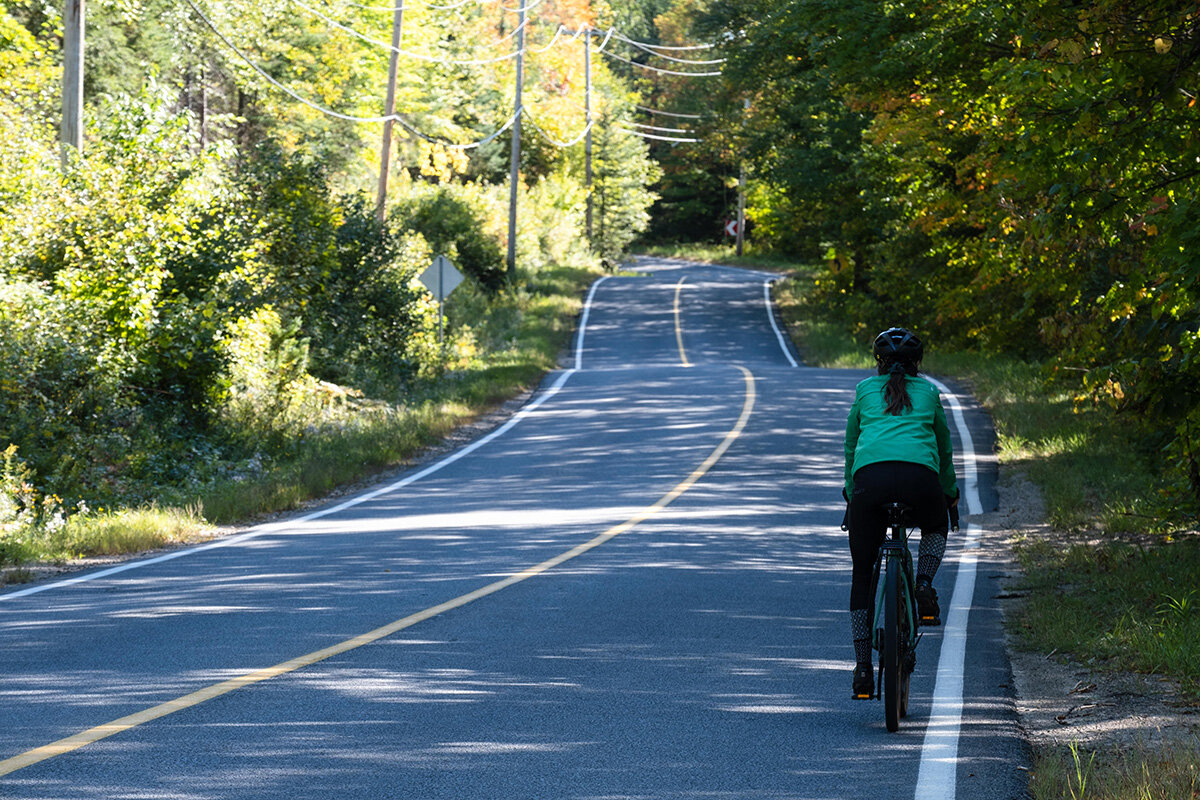
Chemin Adolphe-Chapleau, south of Mont-Laurier, is not very busy.
One of the two covered bridges of Ferme-Route that cross the Lac des Îles.
After this stop at the bridges, I continue east on chemin de Ferme-Rouge towards Kiamika. I leave the river behind and the woods envelop the road so closely that I even see several deer frolicking on both sides.
The landscape of rolling fields and pastures becomes more open on the 6th range in a northerly direction. On this new asphalt, farmers greet me, perched on their tractors as I go up to the junction with the P'tit Train du Nord, also paved.
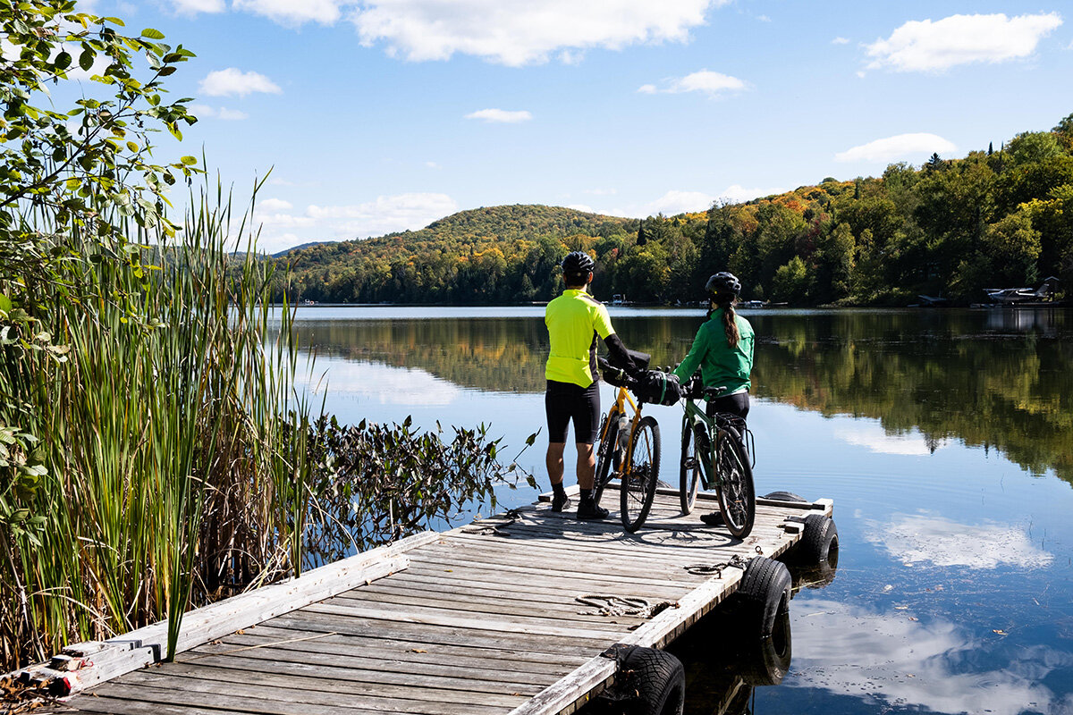
I stop for a moment to admire the vast and serene Lac des Écorces and take the opportunity to put on my windbreaker. Due to the tall trees lining the track and the already setting sun, the light rays are scarce. True to form, I managed to fill a full day with barely forty kilometers of contemplation!
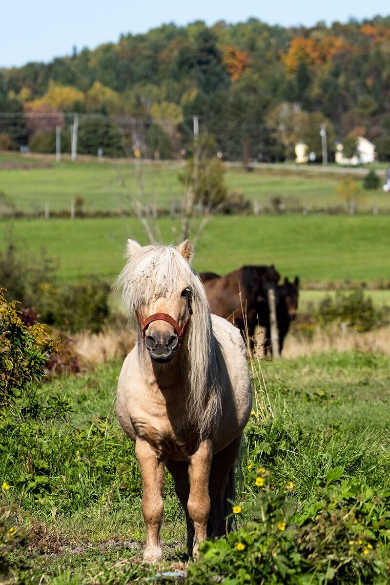
It's the ponies' turn to watch the cyclists go by at Kiamika.
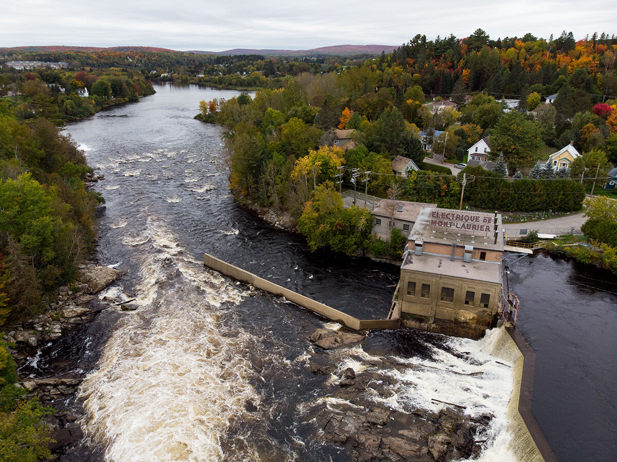
Electric dam at Mont-Laurier.
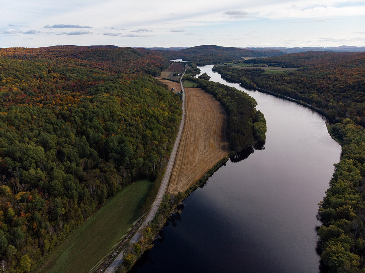
Rivière de la Lièvre south of Mont-Laurier.
My good addresses
- Located right next to the P'tit Train du Nord and Lac Mercier, in the old village of Mont-Tremblant, the magnificent Hotel Mont Tremblant dates from 1902. Its walls are overflowing with photos testifying to this era when the locality was home to only a few wooden buildings. The cuisine of his pub restaurant, Au coin, is also excellent.
- Some hotels hold the Welcome cyclists certification! of Vélo Québec. THE Quality Inn of Mont-Laurier, in particular, can count on an indoor swimming pool and a popular restaurant, as well as a mini-golf course next door. It is possible to enter his bike in the room.
The good world of la Route verte is a 10-episode web series, which I produced for Vélo Québec. All episodes are available for free here. This episode, also in the Laurentians, is about the P'tit Train du Nord, which I (re)do with my father and my brother, 20 years after our first bike trip.
It's official. After a year's break, I'm back on the road! But where ?!